★ 5523 пнт. ♥ 0 им нрави. ⬇ 3 сохранённые
![[Mapporn] What lies beneath Theewaterskloof Dam: blending a contemporary map of the reservoir with an old map from before the da (#Old #Map #Lies #Dam #Beneath #Reservoir) - 1.5 MB Tags: beneath, dam, lies, map, old, reservoir (Pict. in My r/MAPS favs)](https://t.im9.eu/mapporn-what-lies-beneath-theewaterskloof-dam-blending-a-contemporary-map-of-the-reservoir-with-an-old-map-from-before-the-dam-was-built-2333x1541.jpg) Pict. [Mapporn] Linguistic map of the Eastern Roman Empire 560 A.D. [800x799] (#Map #Empire #Roman #Eastern #Linguistic #800x799)Pict. 800×799 px
Pict. [Mapporn] Linguistic map of the Eastern Roman Empire 560 A.D. [800x799] (#Map #Empire #Roman #Eastern #Linguistic #800x799)Pict. 800×799 px★ 6091 пнт. ♥ 0 им нрави. ⬇ 7 сохранённые
![[Mapporn] Linguistic map of the Eastern Roman Empire 560 A.D. [800x799] (#Map #Empire #Roman #Eastern #Linguistic #800x799) - 57 KB Tags: 800x799, eastern, empire, linguistic, map, roman (Pict. in My r/MAPS favs)](https://t.im9.eu/mapporn-linguistic-map-of-the-eastern-roman-empire-560-a-d-800x799.jpg) Pict. [Mapporn] Hand-Drawn Ancestry Map of the Macleods of Lewis-Dunvegan Castle-Huron Township [2448x3212] (#Map #Hand #Castle #Drawn #Lewis #Ancestry)Pict. 2448×3212 px
Pict. [Mapporn] Hand-Drawn Ancestry Map of the Macleods of Lewis-Dunvegan Castle-Huron Township [2448x3212] (#Map #Hand #Castle #Drawn #Lewis #Ancestry)Pict. 2448×3212 px★ 5452 пнт. ♥ 0 им нрави. ⬇ 16 сохранённые
![[Mapporn] Hand-Drawn Ancestry Map of the Macleods of Lewis-Dunvegan Castle-Huron Township [2448x3212] (#Map #Hand #Castle #Drawn #Lewis #Ancestry) - 588 KB Tags: ancestry, castle, drawn, hand, lewis, map (Pict. in My r/MAPS favs)](https://t.im9.eu/mapporn-hand-drawn-ancestry-map-of-the-macleods-of-lewis-dunvegan-castle-huron-township-2448x3212.jpg) Pict. Dove&map ( #Map)Pict. 386×225 px
Pict. Dove&map ( #Map)Pict. 386×225 px★ 1129 пнт. ♥ 0 им нрави. ⬇ 5 сохранённые
 Pict. [Mapporn] High Resolution political map of the world, with countries labeled in their native language[4932x2500] (#High #World #Map #Political #Native #Labeled)Pict. 4932×2500 px
★ 7767 пнт. ♥ 0 им нрави. ⬇ 7 сохранённые
![[Mapporn] High Resolution political map of the world, with countries labeled in their native language[4932x2500] (#High #World #Map #Political #Native #Labeled) - 539 KB Tags: countries, high, labeled, language, map, native, political, resolution, world (Pict. in My r/MAPS favs)](https://t.im9.eu/mapporn-high-resolution-political-map-of-the-world-with-countries-labeled-in-their-native-language-4932x2500.jpg) Pict. [Mapporn] A detailed map of the Atlantic ocean floor (1968) [1403x1839] (#Map #Ocean #Floor #Detailed #Atlantic)Pict. 1403×1839 px
Pict. [Mapporn] A detailed map of the Atlantic ocean floor (1968) [1403x1839] (#Map #Ocean #Floor #Detailed #Atlantic)Pict. 1403×1839 px★ 5585 пнт. ♥ 0 им нрави. ⬇ 8 сохранённые
![[Mapporn] A detailed map of the Atlantic ocean floor (1968) [1403x1839] (#Map #Ocean #Floor #Detailed #Atlantic) - 738 KB Tags: atlantic, detailed, floor, map, ocean (Pict. in My r/MAPS favs)](https://t.im9.eu/mapporn-a-detailed-map-of-the-atlantic-ocean-floor-1968-1403x1839.jpg) Pict. [Mapporn] Official Dutch map of the MH17 debris field, published on August 9, 2014 (source and translation in comments) [1323x11 (#Source #Map #Dutch #Mh17 #Published #Debris)Pict. 1323×1184 px
Pict. [Mapporn] Official Dutch map of the MH17 debris field, published on August 9, 2014 (source and translation in comments) [1323x11 (#Source #Map #Dutch #Mh17 #Published #Debris)Pict. 1323×1184 px★ 7076 пнт. ♥ 0 им нрави. ⬇ 7 сохранённые
![[Mapporn] Official Dutch map of the MH17 debris field, published on August 9, 2014 (source and translation in comments) [1323x11 (#Source #Map #Dutch #Mh17 #Published #Debris) - 335 KB Tags: debris, dutch, field, map, mh17, official, published, source, translation (Pict. in My r/MAPS favs)](https://t.im9.eu/mapporn-official-dutch-map-of-the-mh17-debris-field-published-on-august-9-2014-source-and-translation-in-comments-1323x1184.jpg) Pict. [Mapporn] European Revue - Kill That Eagle. A satirical map of the war in 1914 [1817x × 1264] (#Map #European #Eagle #Revue #Satirical)Pict. 1817×1264 px
Pict. [Mapporn] European Revue - Kill That Eagle. A satirical map of the war in 1914 [1817x × 1264] (#Map #European #Eagle #Revue #Satirical)Pict. 1817×1264 px★ 6113 пнт. ♥ 0 им нрави. ⬇ 5 сохранённые
![[Mapporn] European Revue - Kill That Eagle. A satirical map of the war in 1914 [1817x × 1264] (#Map #European #Eagle #Revue #Satirical) - 338 KB Tags: eagle, european, kill, map, revue, satirical, war (Pict. in My r/MAPS favs)](https://t.im9.eu/mapporn-european-revue-kill-that-eagle-a-satirical-map-of-the-war-in-1914-1817x-1264.jpg) Pict. [Mapporn] Map outlining the British recapture of the Falkland Islands, 1982 [958x1600] (#Map #British #Falkland #958x1600 #Recapture)Pict. 958×1600 px
Pict. [Mapporn] Map outlining the British recapture of the Falkland Islands, 1982 [958x1600] (#Map #British #Falkland #958x1600 #Recapture)Pict. 958×1600 px★ 6554 пнт. ♥ 0 им нрави. ⬇ 8 сохранённые
![[Mapporn] Map outlining the British recapture of the Falkland Islands, 1982 [958x1600] (#Map #British #Falkland #958x1600 #Recapture) - 213 KB Tags: 958x1600, british, falkland, islands, map, outlining, recapture (Pict. in My r/MAPS favs)](https://t.im9.eu/mapporn-map-outlining-the-british-recapture-of-the-falkland-islands-1982-958x1600.jpg) Pict. [Mapporn] Antipode Map with Distances to Territories in the Pacific [1590x808](OC) (#Map #Pacific #Territories #Antipode #Distances)Pict. 1590×808 px
Pict. [Mapporn] Antipode Map with Distances to Territories in the Pacific [1590x808](OC) (#Map #Pacific #Territories #Antipode #Distances)Pict. 1590×808 px★ 5786 пнт. ♥ 0 им нрави. ⬇ 6 сохранённые
![[Mapporn] Antipode Map with Distances to Territories in the Pacific [1590x808](OC) (#Map #Pacific #Territories #Antipode #Distances) - 265 KB Tags: antipode, distances, map, pacific, territories (Pict. in My r/MAPS favs)](https://t.im9.eu/mapporn-antipode-map-with-distances-to-territories-in-the-pacific-1590x808-oc.jpg) Pict. [Mapporn] Map of proposal to divide California into six states [1000x794] (#Map #California #States #Six #Divide #Proposal)Pict. 1000×794 px
Pict. [Mapporn] Map of proposal to divide California into six states [1000x794] (#Map #California #States #Six #Divide #Proposal)Pict. 1000×794 px★ 5639 пнт. ♥ 0 им нрави. ⬇ 3 сохранённые
![[Mapporn] Map of proposal to divide California into six states [1000x794] (#Map #California #States #Six #Divide #Proposal) - 95 KB Tags: california, divide, map, proposal, six, states (Pict. in My r/MAPS favs)](https://t.im9.eu/mapporn-map-of-proposal-to-divide-california-into-six-states-1000x794.jpg) Pict. Dragon&map (#Map #Dragon )Pict. 407×242 px
Pict. Dragon&map (#Map #Dragon )Pict. 407×242 px★ 1653 пнт. ♥ 0 им нрави. ⬇ 18 сохранённые
 Pict. [Mapporn] German propaganda map of the Allies’ colonial empires, circa 1916. [2993x1884] (#Map #German #Propaganda #Empires #Allies)Pict. 2993×1884 px
★ 6243 пнт. ♥ 0 им нрави. ⬇ 3 сохранённые
![[Mapporn] German propaganda map of the Allies’ colonial empires, circa 1916. [2993x1884] (#Map #German #Propaganda #Empires #Allies) - 1.1 MB Tags: allies, circa, colonial, empires, german, map, propaganda (Pict. in My r/MAPS favs)](https://t.im9.eu/mapporn-german-propaganda-map-of-the-allies-colonial-empires-circa-1916-2993x1884.jpg) Pict. [Mapporn] Map of Springfield, the Simpsons [2443x1594] (#Map #Simpsons #Springfield)Pict. 2443×1594 px
Pict. [Mapporn] Map of Springfield, the Simpsons [2443x1594] (#Map #Simpsons #Springfield)Pict. 2443×1594 px★ 5046 пнт. ♥ 0 им нрави. ⬇ 8 сохранённые
![[Mapporn] Map of Springfield, the Simpsons [2443x1594] (#Map #Simpsons #Springfield) - 976 KB Tags: map, simpsons, springfield (Pict. in My r/MAPS favs)](https://t.im9.eu/mapporn-map-of-springfield-the-simpsons-2443x1594.jpg) Pict. [Mapporn] A detailed map of the Indian ocean floor (1967) [1856x1413] (#Map #Indian #Ocean #Floor #Detailed)Pict. 1856×1413 px
Pict. [Mapporn] A detailed map of the Indian ocean floor (1967) [1856x1413] (#Map #Indian #Ocean #Floor #Detailed)Pict. 1856×1413 px★ 5530 пнт. ♥ 0 им нрави. ⬇ 10 сохранённые
![[Mapporn] A detailed map of the Indian ocean floor (1967) [1856x1413] (#Map #Indian #Ocean #Floor #Detailed) - 733 KB Tags: detailed, floor, indian, map, ocean (Pict. in My r/MAPS favs)](https://t.im9.eu/mapporn-a-detailed-map-of-the-indian-ocean-floor-1967-1856x1413.jpg) Pict. mapporn-the-island-of-madagascar-compared-to-alaska-543-524 (#White #World #Map #Wide #Europe #Maps #Asia #Compared #Geography #Stats #Madagascar)Pict. 543×524 px
Pict. mapporn-the-island-of-madagascar-compared-to-alaska-543-524 (#White #World #Map #Wide #Europe #Maps #Asia #Compared #Geography #Stats #Madagascar)Pict. 543×524 px★ 9128 пнт. ♥ 0 им нрави. ⬇ 6 сохранённые
 Pict. Eagle&map (#Map #Eagle )Pict. 483×316 px
★ 1595 пнт. ♥ 0 им нрави. ⬇ 12 сохранённые
 Pict. [Mapporn] The weather map I usually use glitched and showed every weather station symbol in the frame (instead of reducing it to (#Map #Station #Showed #Glitched #Reducing)Pict. 953×596 px
★ 6678 пнт. ♥ 0 им нрави. ⬇ 4 сохранённые
![[Mapporn] The weather map I usually use glitched and showed every weather station symbol in the frame (instead of reducing it to (#Map #Station #Showed #Glitched #Reducing) - 207 KB Tags: glitched, map, reducing, showed, station, symbol, use, weather (Pict. in My r/MAPS favs)](https://t.im9.eu/mapporn-the-weather-map-i-usually-use-glitched-and-showed-every-weather-station-symbol-in-the-frame-instead-of-reducing-it-to-only-a-few-symbols-as-you-zoom-out-the-result-was-really-nifty-953x596.jpg) Pict. Europe Central Light Pollution Map - 1 (#Map #Europe #Light #Pollution)Pict. 770×508 px
Pict. Europe Central Light Pollution Map - 1 (#Map #Europe #Light #Pollution)Pict. 770×508 px★ 4559 пнт. ♥ 0 им нрави. ⬇ 0 сохранённые
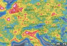 Pict. [Mapporn] Voronoi Map of Closest International Airport to any Point on the Globe [2038x1014] (#Map #Point #Globe #Closest #Voronoi)Pict. 2038×1014 px
★ 6624 пнт. ♥ 0 им нрави. ⬇ 8 сохранённые
![[Mapporn] Voronoi Map of Closest International Airport to any Point on the Globe [2038x1014] (#Map #Point #Globe #Closest #Voronoi) - 427 KB Tags: airport, closest, globe, international, map, point, voronoi (Pict. in My r/MAPS favs)](https://t.im9.eu/mapporn-voronoi-map-of-closest-international-airport-to-any-point-on-the-globe-2038x1014.jpg) Pict. [Mapporn] 1878 map of Paris [2782x1835] (#Map #Paris )Pict. 2782×1835 px
Pict. [Mapporn] 1878 map of Paris [2782x1835] (#Map #Paris )Pict. 2782×1835 px★ 4572 пнт. ♥ 0 им нрави. ⬇ 9 сохранённые
![[Mapporn] 1878 map of Paris [2782x1835] (#Map #Paris ) - 883 KB Tags: map, paris (Pict. in My r/MAPS favs)](https://t.im9.eu/mapporn-1878-map-of-paris-2782x1835.jpg) Pict. [Mapporn] A 2016 version of the 1914 Isochronic London-World travel times map [1722x2200] Credit to fromrome2rio (#World #Map #London #Travel #Credit)Pict. 1722×2200 px
Pict. [Mapporn] A 2016 version of the 1914 Isochronic London-World travel times map [1722x2200] Credit to fromrome2rio (#World #Map #London #Travel #Credit)Pict. 1722×2200 px★ 5454 пнт. ♥ 0 им нрави. ⬇ 9 сохранённые
![[Mapporn] A 2016 version of the 1914 Isochronic London-World travel times map [1722x2200] Credit to fromrome2rio (#World #Map #London #Travel #Credit) - 867 KB Tags: credit, london, map, travel, world (Pict. in My r/MAPS favs)](https://t.im9.eu/mapporn-a-2016-version-of-the-1914-isochronic-london-world-travel-times-map-1722x2200-credit-to-fromrome2rio.jpg) Pict. [Mapporn] 1525 Map of the World [4298 X 3044] (#World #Map )Pict. 2579×1826 px
Pict. [Mapporn] 1525 Map of the World [4298 X 3044] (#World #Map )Pict. 2579×1826 px★ 4203 пнт. ♥ 0 им нрави. ⬇ 9 сохранённые
![[Mapporn] 1525 Map of the World [4298 X 3044] (#World #Map ) - 988 KB Tags: map, world (Pict. in My r/MAPS favs)](https://t.im9.eu/mapporn-1525-map-of-the-world-4298-x-3044.jpg) Pict. [Pics] My wife made this star map shawl. It is beaded with over 350 beads to represent the night sky as seen from the North Pole (#Wife #Night #Map #Star #Shawl #Beaded #Represent)Pict. 960×552 px
Pict. [Pics] My wife made this star map shawl. It is beaded with over 350 beads to represent the night sky as seen from the North Pole (#Wife #Night #Map #Star #Shawl #Beaded #Represent)Pict. 960×552 px★ 11k пнт. ♥ 0 им нрави. ⬇ 10 сохранённые
![[Pics] My wife made this star map shawl. It is beaded with over 350 beads to represent the night sky as seen from the North Pole (#Wife #Night #Map #Star #Shawl #Beaded #Represent) - 90 KB Tags: beaded, beads, map, night, north, pole, represent, shawl, sky, star, wife (Pict. in My r/PICS favs)](https://t.im9.eu/pics-my-wife-made-this-star-map-shawl-it-is-beaded-with-over-350-beads-to-represent-the-night-sky-as-seen-from-the-north-pole-1.jpg)