Pict. [Earthporn] Lake of the Woods, Canada. Contains more than 14,552 islands and 65,000 miles of shoreline. Crazy! [4526x2546] (#Lake #Canada #Islands #Miles #Shoreline)Pict. 4526×2546 px![[Earthporn] Lake of the Woods, Canada. Contains more than 14,552 islands and 65,000 miles of shoreline. Crazy! [4526x2546] (#Lake #Canada #Islands #Miles #Shoreline) - 644 KB Tags: canada, crazy, islands, lake, miles, shoreline, woods (Pict. in My r/EARTHPORN favs)](https://t.im9.eu/earthporn-lake-of-the-woods-canada-contains-more-than-14-552-islands-and-65-000-miles-of-shoreline-crazy-4526x2546.jpg) Pict. Aerial Shoreline Lanting (#Aerial #Lanting #Shoreline)Pict. 1024×768 px
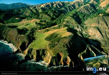
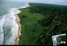
Pict. Aerial Shoreline Lanting (#Aerial #Lanting #Shoreline)Pict. 1024×768 px Pict. Loango Shoreline (#Shoreline #Loango )Pict. 1024×768 px
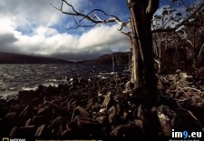
 Pict. Rocky Shoreline (#Rocky #Shoreline )Pict. 1024×768 px
 Pict. [Mapporn] Global elevation and shoreline data in Fuller Dymaxion form [5760x2880px]. Article and 43200x21600px TIFF in the comme (#Data #Form #Elevation #Comme #Shoreline)Pict. 5760×2880 px
![[Mapporn] Global elevation and shoreline data in Fuller Dymaxion form [5760x2880px]. Article and 43200x21600px TIFF in the comme (#Data #Form #Elevation #Comme #Shoreline) - 632 KB Tags: article, comme, data, elevation, form, global, shoreline (Pict. in My r/MAPS favs)](https://t.im9.eu/mapporn-global-elevation-and-shoreline-data-in-fuller-dymaxion-form-5760x2880px-article-and-43200x21600px-tiff-in-the-comments.jpg) Pict. [Mapporn] Modern map of Boston compared to original shoreline. [2610x3284] (#Map #Original #Modern #Compared #Boston #Shoreline)Pict. 2610×3284 px
Pict. [Mapporn] Modern map of Boston compared to original shoreline. [2610x3284] (#Map #Original #Modern #Compared #Boston #Shoreline)Pict. 2610×3284 px![[Mapporn] Modern map of Boston compared to original shoreline. [2610x3284] (#Map #Original #Modern #Compared #Boston #Shoreline) - 1.5 MB Tags: boston, compared, map, modern, original, shoreline (Pict. in My r/MAPS favs)](https://t.im9.eu/mapporn-modern-map-of-boston-compared-to-original-shoreline-2610x3284.jpg)
★ 340k пнт. ♥ 0 им нрави. ⬇ 11 сохранённые
![[Earthporn] Lake of the Woods, Canada. Contains more than 14,552 islands and 65,000 miles of shoreline. Crazy! [4526x2546] (#Lake #Canada #Islands #Miles #Shoreline) - 644 KB Tags: canada, crazy, islands, lake, miles, shoreline, woods (Pict. in My r/EARTHPORN favs)](https://t.im9.eu/earthporn-lake-of-the-woods-canada-contains-more-than-14-552-islands-and-65-000-miles-of-shoreline-crazy-4526x2546.jpg) Pict. Aerial Shoreline Lanting (#Aerial #Lanting #Shoreline)Pict. 1024×768 px
Pict. Aerial Shoreline Lanting (#Aerial #Lanting #Shoreline)Pict. 1024×768 px★ 90k пнт. ♥ 0 им нрави. ⬇ 8 сохранённые
 Pict. Loango Shoreline (#Shoreline #Loango )Pict. 1024×768 px
★ 89k пнт. ♥ 0 им нрави. ⬇ 9 сохранённые
 Pict. Rocky Shoreline (#Rocky #Shoreline )Pict. 1024×768 px
★ 89k пнт. ♥ 0 им нрави. ⬇ 3 сохранённые
 Pict. [Mapporn] Global elevation and shoreline data in Fuller Dymaxion form [5760x2880px]. Article and 43200x21600px TIFF in the comme (#Data #Form #Elevation #Comme #Shoreline)Pict. 5760×2880 px
★ 6269 пнт. ♥ 0 им нрави. ⬇ 6 сохранённые
![[Mapporn] Global elevation and shoreline data in Fuller Dymaxion form [5760x2880px]. Article and 43200x21600px TIFF in the comme (#Data #Form #Elevation #Comme #Shoreline) - 632 KB Tags: article, comme, data, elevation, form, global, shoreline (Pict. in My r/MAPS favs)](https://t.im9.eu/mapporn-global-elevation-and-shoreline-data-in-fuller-dymaxion-form-5760x2880px-article-and-43200x21600px-tiff-in-the-comments.jpg) Pict. [Mapporn] Modern map of Boston compared to original shoreline. [2610x3284] (#Map #Original #Modern #Compared #Boston #Shoreline)Pict. 2610×3284 px
Pict. [Mapporn] Modern map of Boston compared to original shoreline. [2610x3284] (#Map #Original #Modern #Compared #Boston #Shoreline)Pict. 2610×3284 px★ 5736 пнт. ♥ 0 им нрави. ⬇ 1 сохранённые
![[Mapporn] Modern map of Boston compared to original shoreline. [2610x3284] (#Map #Original #Modern #Compared #Boston #Shoreline) - 1.5 MB Tags: boston, compared, map, modern, original, shoreline (Pict. in My r/MAPS favs)](https://t.im9.eu/mapporn-modern-map-of-boston-compared-to-original-shoreline-2610x3284.jpg)